Walks Around Corbridge: Riverside and Countryside
Published walks from Corbridge village: the Tyne floodbank towards Dilston, the riverside path to Corbridge Roman Town, the Aydon Castle circular and the route north to Hadrian's Wall, with parking, train and flooding advice.
Corbridge sits on the north bank of the River Tyne, with farmland rising behind it towards Hadrian's Wall. That makes it a good base for walking: you can be on the riverbank within a few minutes of the Market Place, and out among fields and woodland not long after. This guide gathers walks that have been published by walkers and trail organisations, with links to each source so you can check the full route before you set out. Distances are approximate and come from those sources.
Getting there and parking
Corbridge station is on the Tyne Valley line, with an hourly Northern service between Newcastle and Hexham and a journey of about 41 minutes from Newcastle. Visit Corbridge says the station is about half a mile from the village centre, "a lovely walk over the bridge". It is unstaffed, tickets are sold from a machine on the Newcastle-bound platform, and the westbound platform is reached only by stairs.
Drivers can use the free Corbridge Village Car Park on the south side of the bridge, which has 86 spaces according to Visit Corbridge's parking page. The Cow Lane car park, next to the middle school, is open only at weekends and in school holidays.
The bridge and the floodbank towards Dilston
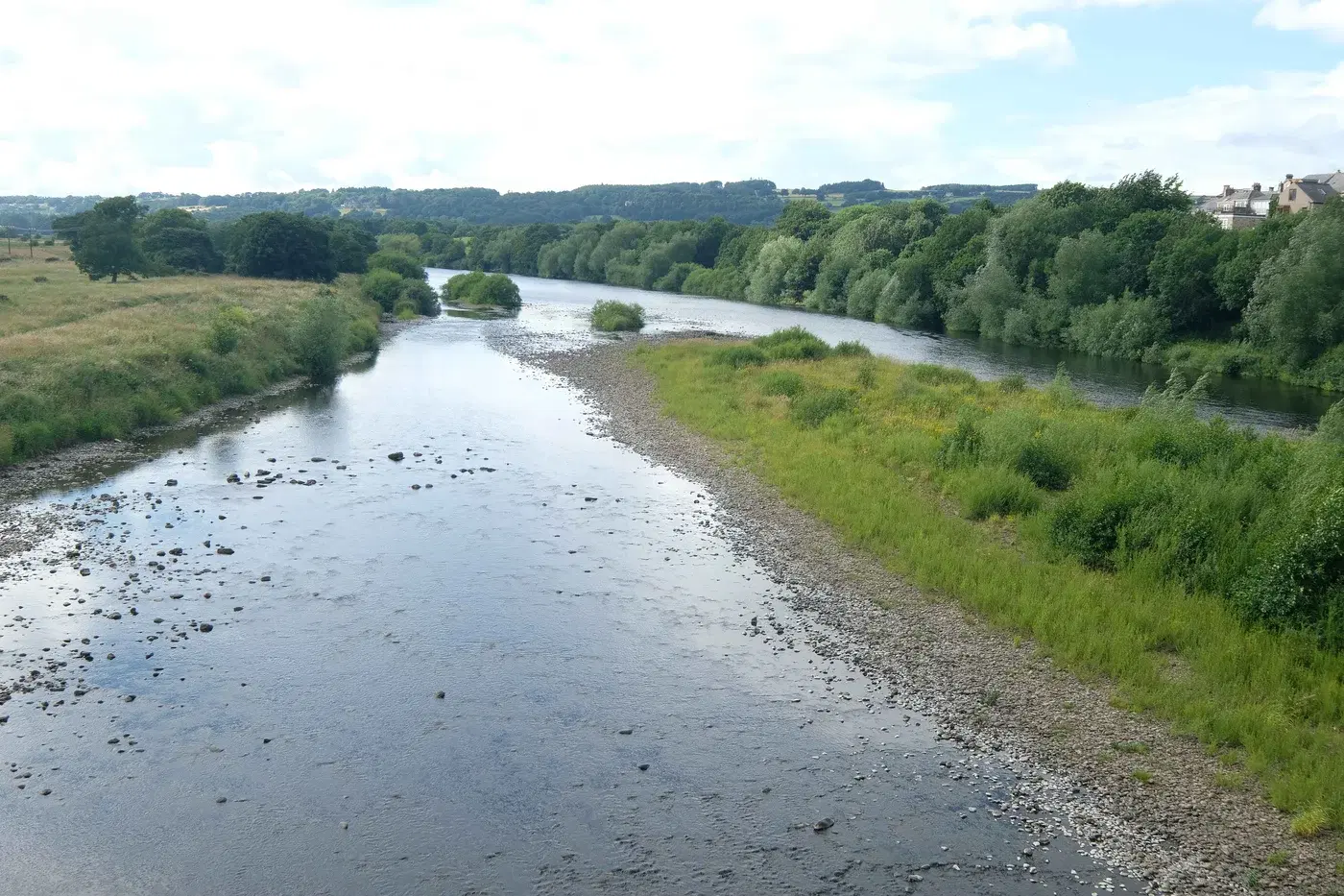
Most riverside walks here start at the seven-arched bridge, completed in 1674 and the only Tyne bridge to survive the great flood of 1771. A route published on Andrew's Walks crosses it from Princes Street and, at the far end, turns right onto a path along the top of the flood defence towards Dilston. The walkers followed it to the point where the Devil's Water flows into the Tyne, then retraced their steps to the bridge.
This is the low-lying side of the river. Northumberland County Council's flood investigation report records that during Storm Desmond in December 2015 the defences at Corbridge were overtopped, and that most of the flooding was on the southern side of the river, including Dilston Haugh. The riverside path between Dilston Bridge and the car park near Corbridge bridge has also been closed in the past for Environment Agency repairs to the embankment.
Best for:
Avoid the floodbank when the Tyne is running high. Check the Environment Agency's flood warnings for the Tyne before you go, and turn back if the path is under water or signed as closed.
Along the river to Corbridge Roman Town
The same Andrew's Walks route continues on the north side. From the north end of the bridge a path follows the bank of the Tyne west, then leaves the river for a short stretch of road before reaching Corbridge Roman Town. The walkers returned to the village past St Andrew's Church, whose tower arch is built from reused Roman stones. Together with the floodbank stretch, their walk came to about 5.1 miles with very little climbing.
English Heritage describes the Roman Town as the most northerly town in the Roman Empire, with a walkable Roman main street and a museum holding the Corbridge Hoard.
Best for:
At the time of writing, English Heritage lists the Roman Town as open on Saturdays and Sundays, 10am to 4pm. Check the English Heritage page before planning a visit around it.
The Aydon Castle circular
For countryside rather than river, the best-documented route is the Corbridge to Aydon Castle walk published on Fabulous North. It is about 10km (6 miles) with 172m of ascent, and the author calls it a "fairly easy wander" of around two hours. It starts at the village car park, crosses the bridge and heads up Main Street past Low Hall, then follows field paths by Thornborough, crosses the A69 on a bridge and passes a disused lime kiln. Beyond the hamlet of Aydon it drops through woodland to the Cor Burn, climbs to Aydon Castle and returns to the village along Deadridge Lane.
National Trails also lists a 6-mile Corbridge circular walk taking in the Roman town and Aydon Castle, with a more generous estimate of four to five hours.
Aydon Castle itself, a 13th-century fortified manor house, is closed for the winter and reopens in 2027, so you will not be able to go inside. Walkers' reports describe public paths leading past it, but check the current position on Northumberland County Council's rights of way map before relying on the stretch near the castle.
Best for:
The Fabulous North author found the footbridge over the Cor Burn collapsed and had to step across the burn and climb a muddy bank. A replacement was due by September 2023, so check for temporary path closures. The route also crosses fields with cattle and sheep, so keep dogs on a lead.
North to Hadrian's Wall
English Heritage notes that the Roman Town lies about 2.5 miles south of Hadrian's Wall, and that Aydon Castle is less than a mile from the Hadrian's Wall Path. For a full day, 10Adventures publishes a Corbridge to Chollerford walk of about 17km (10.6 miles), taking four to six hours. It starts opposite the Post Office on Princes Street, heads north-west past the Roman site, crosses the A69 and climbs over open farmland to join the Hadrian's Wall Path, then follows the Wall west to Chollerford on the North Tyne.
Best for:
This is a one-way route, so arrange your return to Corbridge before you set off rather than relying on finding transport at Chollerford.
What to wear
None of these routes are technical, but they mix tarmac with farmland, woodland and riverbank. Waterproof walking boots are sensible for most of the year, particularly for the Cor Burn crossing on the Aydon route and the grass of the floodbank after rain. Take a map or a mapping app as well as the published route notes, since stiles, gates and field boundaries change.
Where to finish
Corbridge is well placed for a drink or a meal at the end. Near the bridge, The Angel of Corbridge on Main Street says it dates back to at least 1569, and The Golden Lion on Hill Street and the Black Bull on Middle Street are a short walk away. The Pele is a micro bar on the Market Place. If you arrived by train, The Dyvels Inn and The Valley, in the Old Station House, are both on Station Road.
For coffee and cake, try Tea & Tipple on the Market Place or Coffuffle on Middle Street. Grant's Bakery and The Corbridge Larder are handy for picking up food before you head out. Further afield, Dilston Physic Garden south of the river opens on Friday to Sunday afternoons until 20 December and then closes until February, so check its hours if you plan to combine it with a walk.
Know a Corbridge walk we've missed, or spotted a path closure? Get in touch and we'll add it to this guide.
Local businesses mentioned
Corbridge Roman Town
Corchester Lane, Corbridge, Northumberland, NE45 5NT
St Andrew's Church, Corbridge
St Andrew's Church, Market Place, Corbridge, Northumberland, NE45 5AA
Dilston Physic Garden
Dilston Physic Garden, Corbridge, Northumberland, NE45 5QZ
The Angel of Corbridge
Main Street, Corbridge, Northumberland, NE45 5LA
Black Bull
Middle Street, Corbridge, Northumberland, NE45 5AT
The Golden Lion
Hill Street, Corbridge, Northumberland, NE45 5AA
The Dyvels Inn
Station Road, Corbridge, Northumberland, NE45 5AY
The Pele
Market Place, Corbridge, Northumberland, NE45 5AW
The Valley
Old Station House, Station Road, Corbridge, Northumberland, NE45 5AY
Tea & Tipple
18 Market Place, Corbridge, Northumberland, NE45 5AW
Coffuffle
3 Jubilee Buildings, Middle Street, Corbridge, Northumberland, NE45 5AT
Grant's Bakery
1 Market Place, Corbridge, Northumberland, NE45 5AW
The Corbridge Larder
18 Hill Street, Corbridge, Northumberland, NE45 5AA
Never miss what’s on
Join the weekly CorbridgeVillage.live digest — the best events, news and local tips, straight to your inbox. One email a week.
What's On
Tynedale v Chester (National League 2 North)
2:00 PM · Tynedale Park, Station Road, Corbridge NE45 5AY
Remembrance Sunday Civic Service
10:40 AM · St Andrew's Church, Market Place, Corbridge NE45 5AA
Long Weekend Christmas Shopping at Dilston Physic Garden
12:00 PM - 3:00 PM · Dilston Physic Garden, Dilston, Corbridge NE45 5QZ